
2026-08-14
Gap: Riverbank drop depth was a guessed setting
This work closed three gaps: an unmeasured carving setting, a stale-geometry merge bug, and an unwatched terrain defect.
Gap: Riverbank drop depth was a guessed setting
One class of riverbank, where ground drops on a carved channel's low side, used a never-measured cut-depth setting. A read-only pass over every flagged site found a median depth of 0.76 metres, a 90th-percentile depth of 1.63 metres, and confirmed the safety ceiling never applied (9.89 metres of headroom at the closest call). It was replaced with a 2.0-metre ceiling, clamped automatically to the terrain.
The first rebuild showed zero effect: the measurement read depth against smooth ground, not the already-carved ground beneath the water. Correcting it produced 104 corrections at a median depth of 0.79 metres, matching the original diagnosis. A later smoothing pass reintroduced tilt on corrected sites; rerunning the correction after smoothing closed that gap too.
Gap: Stale river geometry could get merged into a fresh build
In-game testing found five visible problems, the most significant a jagged riverbank edge. Rivers excluded from a build for failing validation left old geometry behind, and the merge step combined fresh rivers with geometry up to five days old, producing a visible seam.
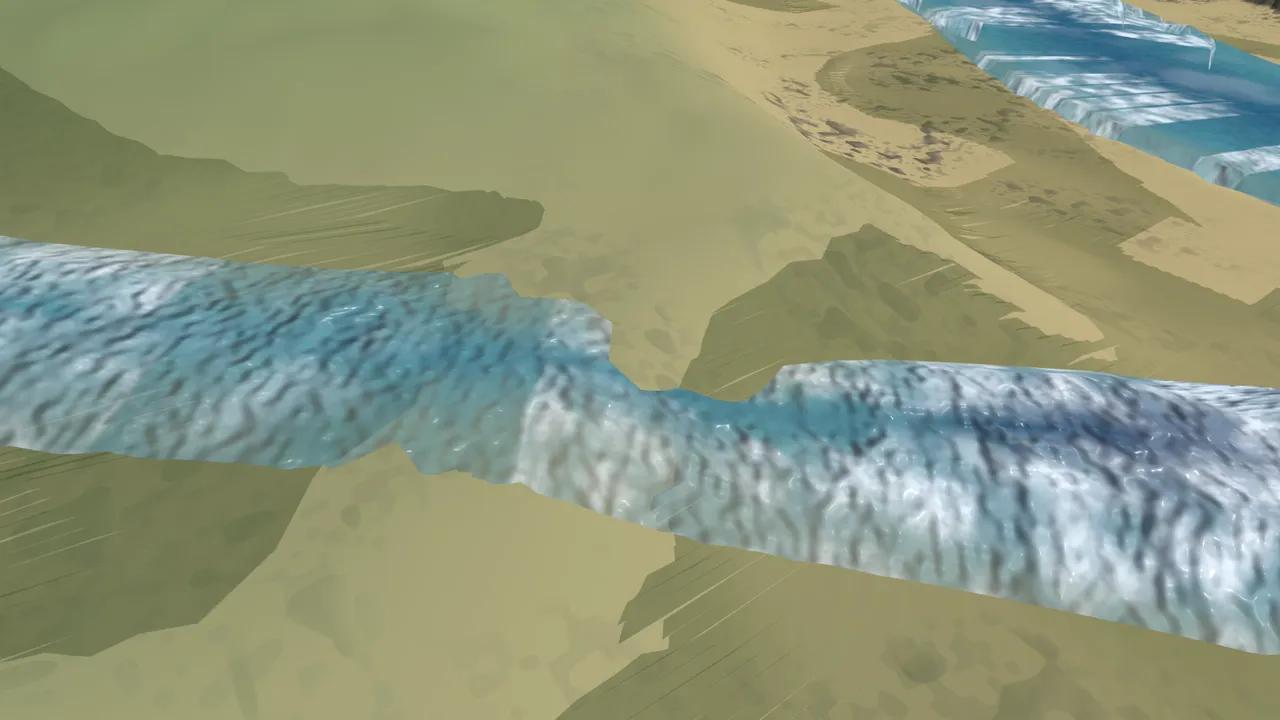
The fix stamps the build's start time and refuses any river whose saved geometry predates it, rejecting 32 rivers on its first run, mostly leftover tilt corrections. A related timing bug was fixed at the same time: the grass-height texture read pre-carve terrain while the ground rendered the carved version.
Gap: Ground could poke through a flat water surface unnoticed
A screenshot showed ground poking through a flat stretch of river as a visible wedge. A dedicated pass found 2,450 terrain cells with the same problem across the map: ground bulging up between the sample points the existing check tests, not at them.
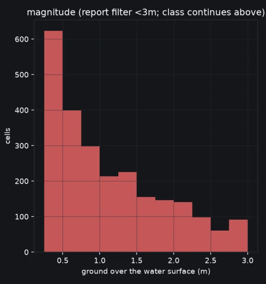
164 rivers are accounted for: 126 freshly rebuilt, 26 kept from a still-valid build, 6 never built, and 6 excluded. The wedge defect carries forward as an open item.